
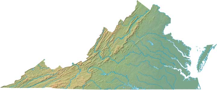
Virginia Relief Map
Static Virginia Relief Map
Interactive Virginia Relief Maps
The interactive relief map choices include a standard Google terrain map and an enhanced Google terrain map with Street View capabilities. To zoom in or out on either of these Virginia maps, click or touch its plus (+) button or its minus (-) button, respectively. To pan either map in any direction, simply swipe it or drag it in that direction. To display either of these Virginia terrain maps, click or touch one of the following menu options.
Virginia's highest mountain is Mount Rogers, whose peak is 5,729 feet above sea level. The largest lake in Virginia is Smith Mountain Lake. If you are planning a visit to Virginia, please see Virginia Is For Lovers, the official state tourism site, where you can find a wide range of travel and vacation information. For information about Virginia history and recreational activities, visit the following National Park sites.
Virginia National Parks
- Appalachian National Scenic Trail
- Appomattox Court House National Historical Park
- Arlington House - The Robert E. Lee Memorial
- Assateague Island National Seashore
- Blue Ridge Parkway
- Booker T Washington National Monument
- Cape Henry Memorial
- Cedar Creek & Belle Grove National Historical Park
- Chesapeake Bay Gateways Network
- Claude Moore Colonial Farm
- Colonial National Historical Park
- Fredericksburg & Spotsylvania National Park
- George Washington Birthplace National Monument
- George Washington Memorial Parkway
- Great Falls Park
- Green Springs
- Jamestown National Historic Site
- Lyndon Baines Johnson Memorial Grove on the Potomac
- Maggie L Walker National Historic Site
- Manassas National Battlefield Park
- Overmountain Victory National Historic Trail
- Petersburg National Battlefield
- Potomac Heritage National Scenic Trail
- Prince William Forest Park
- Richmond National Battlefield Park
- Shenandoah National Park
- Theodore Roosevelt Island Park
- Wolf Trap National Park for the Performing Arts
- Yorktown Battlefield
- Yorktown National Cemetery
Copyright © 2005-2025 State-Maps.org. All rights reserved.
Virginia-Map.org is a State Maps reference source.
To facilitate browsing, certain external links will open in new windows.
Virginia-Map.org is a State Maps reference source.
To facilitate browsing, certain external links will open in new windows.